SRT and LRF files: what your drone writes alongside the video
 MaximAugust 18, 2026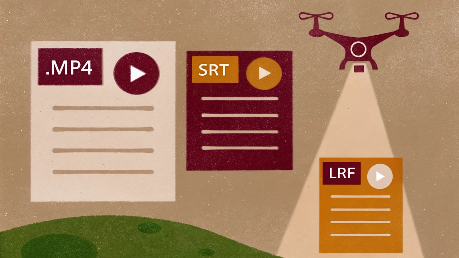
You land, pull the card, and find three files where you expected one. There is the video itself, and then two smaller files sitting next to it with the same name and different extensions. Most pilots delete them without looking. One of them deserves better.
The SRT file is your flight record
An SRT file is a subtitle file. The format is SubRip, the same plain text format that carries dialogue in a downloaded film, and DJI has quietly repurposed it to carry flight data instead. Open one in a text editor and you will find a timestamped block for every second of the video, each holding a snapshot of what the aircraft and camera were doing at that moment.
What is in each block depends on the aircraft and the firmware, and the field names shift between models, but the useful ones are consistent. Latitude and longitude. Relative altitude, measured from where you took off, and absolute altitude above sea level. ISO, shutter speed, f number and focal length. A single line looks roughly like this:
[latitude: 53.408371] [longitude: -2.991573]
[rel_alt: 42.300 abs_alt: 78.110] [iso: 100] [shutter: 1/240]
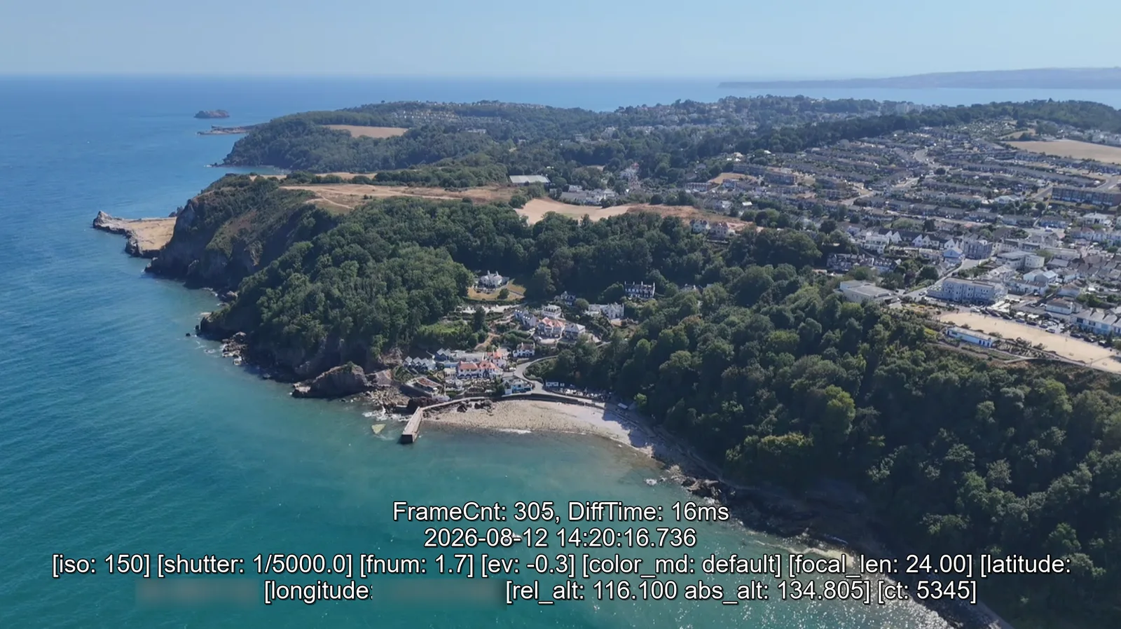
That is a per second record of where you were, how high you were and how the camera was set, tied to the frame it belongs to. For a working pilot it is worth more than it looks. It is the answer when a client asks what height a shot was taken from. It is the fastest way to work out why one clip is sharp and the next is not, because the settings are right there next to the frames. It will reconstruct your flight path on a map without any separate logging app. And if anyone ever asks you to demonstrate where and when a flight took place, the file was written at the time by the aircraft rather than typed up afterwards by you.
It is also a few kilobytes. There is no reason to delete it. If you keep a flight log, Terasor's Flight Log can read it and turn it into a route, a height graph and a logbook entry.
One thing worth knowing before the job rather than after. The SRT is only written if captions are switched on in the flying app. If the setting is off, the file simply does not exist and there is nothing to recover once you have landed. If you want the record, check it before you fly.
And one thing worth knowing before you hand footage over. The SRT contains precise coordinates. Sending a client the raw folder sends them exactly where you flew, second by second. That is usually fine and occasionally it is not, on private land, secure sites or anywhere the location itself is the sensitive part. It takes two seconds to pull the file out of the folder, and no time at all to wish you had.
The LRF file is a rough copy
LRF stands for low resolution footage, and that is exactly what it is: a small proxy of the main clip, written at the same time. On a Mini 4 Pro it runs at 1280 by 720 and around 19 megabits per second, measured from a real clip rather than taken from a spec sheet: 75 seconds of footage produced a 174 MB proxy, a fraction of the size of the 4K original it shadows. Other drones differ, so check yours rather than assuming.
It exists so your phone can do something useful. Scrubbing through 4K or 5.3K footage over a wireless link is painful, so the app plays the proxy instead. It is also the reason a quick review on the tablet at the side of a field feels instant when the same file on a laptop takes a moment to open.
In the edit it has a second life. Premiere Pro, DaVinci Resolve, Final Cut and the rest all support proxy workflows, where you cut against small files and relink to the originals before export. LRF files are already sitting there doing that job for free, which saves generating proxies yourself on a machine that would rather be doing something else.
Once the footage is offloaded and the edit is finished, the LRF has done its work. Delete it without ceremony.
The short version
Keep the SRT. It is tiny, it is the only record of where and how you flew, and it cannot be recreated after the fact. Bin the LRF once you have cut the job, because it is a copy of something you still have. And check the caption setting before the next flight, because the file you want is the one that has to be switched on in advance.
If you would rather know what the airspace looks like before you take off than what it looked like afterwards, the free Terasor flight planner covers live restriction zones, weather and daylight, and needs no account.
Sources
Co-Founder, Terasor
Documentary and portrait photographer, UK
Maxim is Co-Founder of Terasor and a UK based documentary and portrait photographer. He flies a DJI Mini 4 Pro and writes about UK drone regulations, the wider industry, and the platform from a working photographer's point of view.
LinkedIn